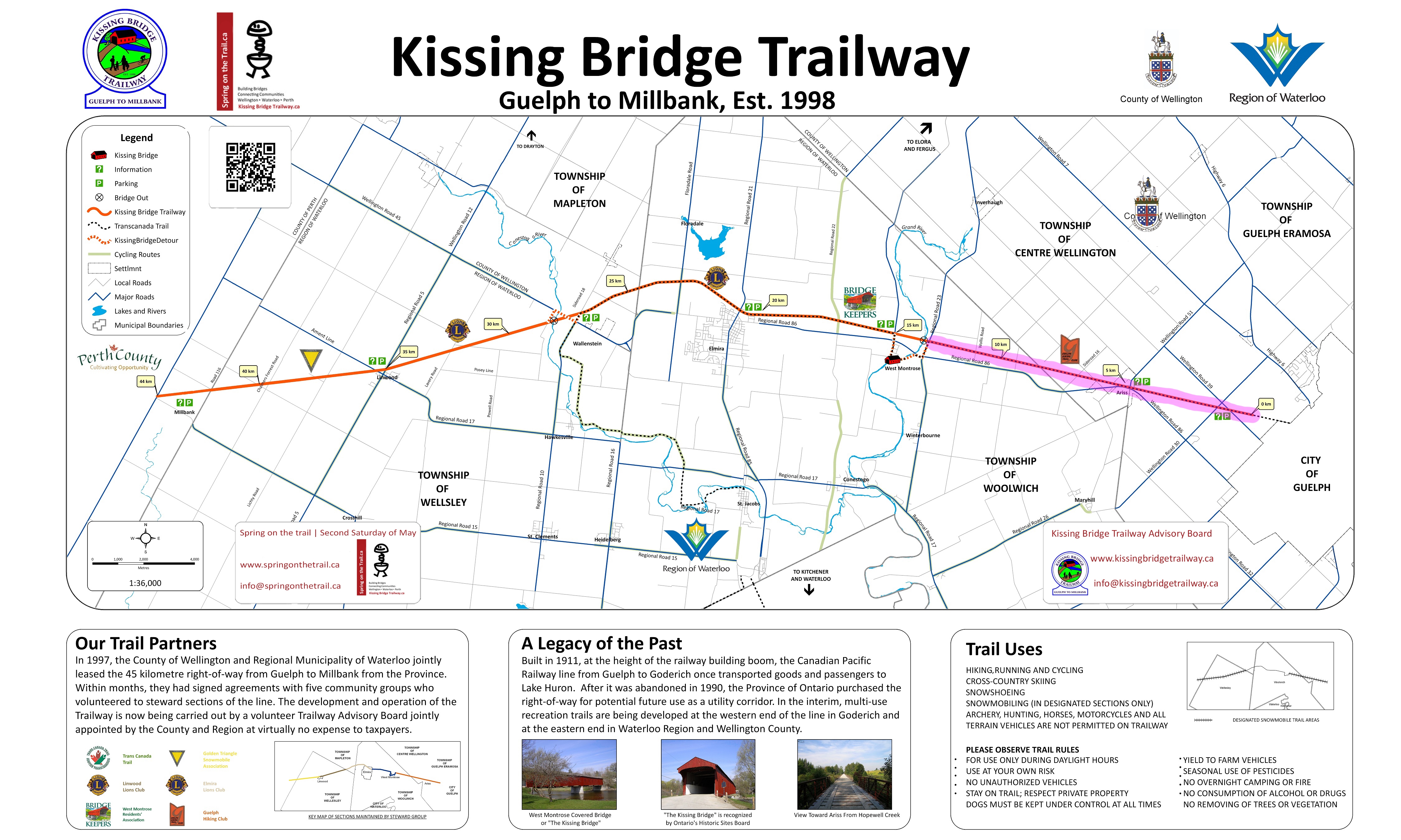
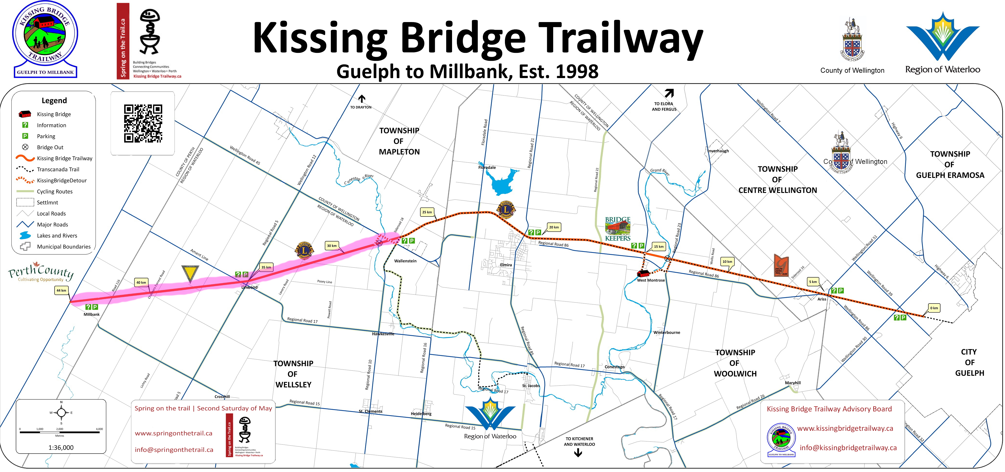
Kissing Bridge Trailway (KBT)
The Kissing Bridge Trailway is a 45-kilometre part of the 132-kilometre Guelph to Goderich (G2G) Rail Trail.
For more information, please visit https://www.kissingbridgetrailway.ca/
Here are the different 20-30km sections (10-15 km to one point, and then 10-15km back to your car), so doing this trail may require more than one visit to complete if you go with your family:
Section 1: G2G Trailhead 0km marker to West Montrose
Section Last ridden: Summer 2021
- Terrain: Flat, fine stone chip Rail Trail (suitable for any bike except road bikes)
- Parking (East): 5559 Wellington County Rd 39, Guelph, ON (recommended, but not many parking spots)
- Parking (West): 752 Katherine Street North, West Montrose, Ontario. (Warning: mostly grass; not recommended parking in wet weather)
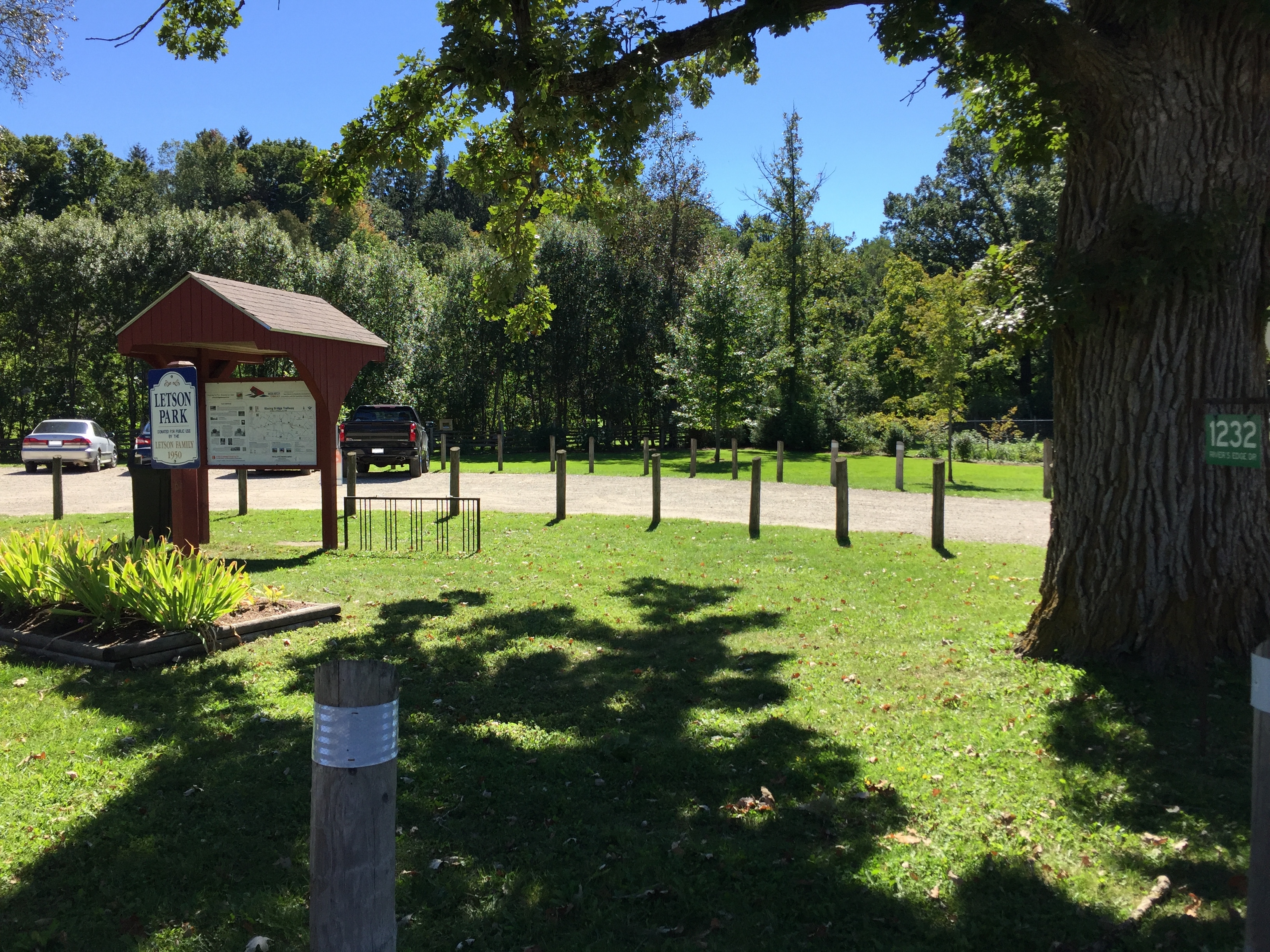
- Extra Parking: Letson Park (5-10 car parking), 1232 River's Edge Drive, West Montrose, Ontario.
- Washrooms: One portable bathroom at Letson Park, 1232 River's Edge Drive, West Montrose, Ontario.
- Food: Lost Acre Variety (General Store), 12 Covered Bridge Dr, West Montrose, ON (Closed Sunday and Monday)
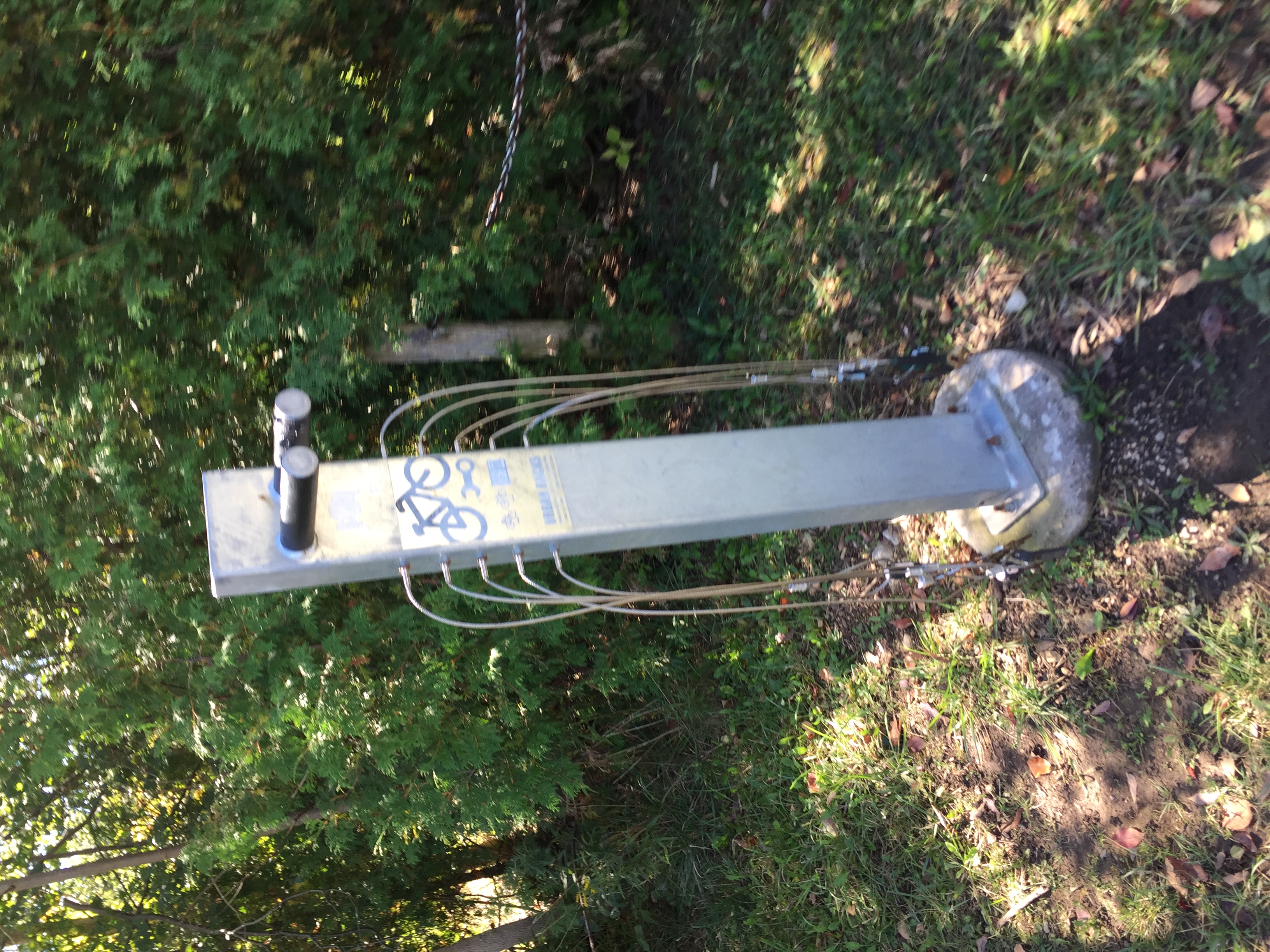
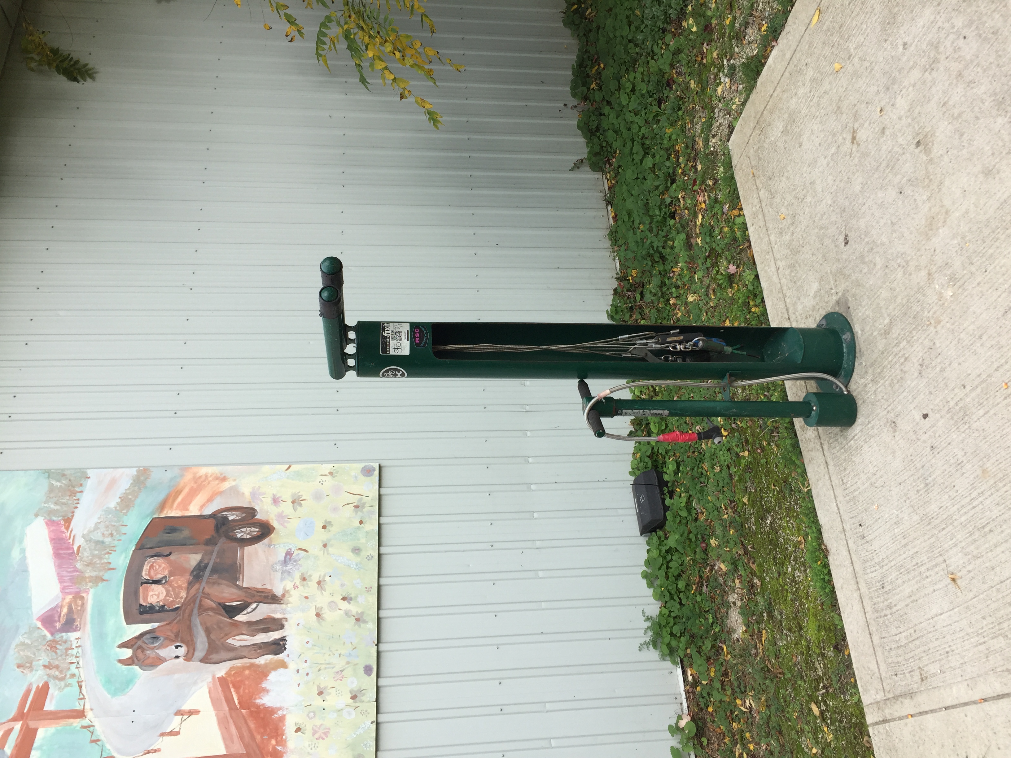
- Bike Repair Stand: There is one at the G2G Trailhead's 0km marker/kiosk, across from the 5559 Wellington County Rd 39, Guelph, ON parking lot. Does NOT have bicycle pump.
- Nearby Attraction: West Montrose Covered bridge, the last remaining covered bridge in Ontario.
- Other facilities: Outdoor library (take a book, leave a book) at Letson Park, 1232 River's Edge Drive, West Montrose, Ontario.
If you are going to do only one stretch of this KBT trail, do this one. Recommendation is to start this course from the East to the West. You'll be passing through the community of Ariss (another parking lot for ~20 cars). You will know that you reach the end of this section (the old railway bridge is out) when you are surrounded by cedars under the Katherine Street bridge near a stairwell.
At this point, you can either turn around back where you came from, or cycle a handful of kilometers on public roads to see the West Montrose Covered bridge, the last remaining covered bridge in Ontario. A stairway (with bike ramp) will lead you up the Katherine Street parking lot; go south on Katherine Street, cross the intersection and the next right (immediately after the intersection) will be River's Edge Road, which you will follow to the covered bridge. There is a public washroom at Letson Park south of the bridge and the Lost Acre Variety (General Store (closed Sunday and Monday)) on the north side of the bridge for some drinks/bananas/snacks/ice cream and baked goods.
Section 2: West Montrose to Wallenstein
Section Last ridden: Fall 2021
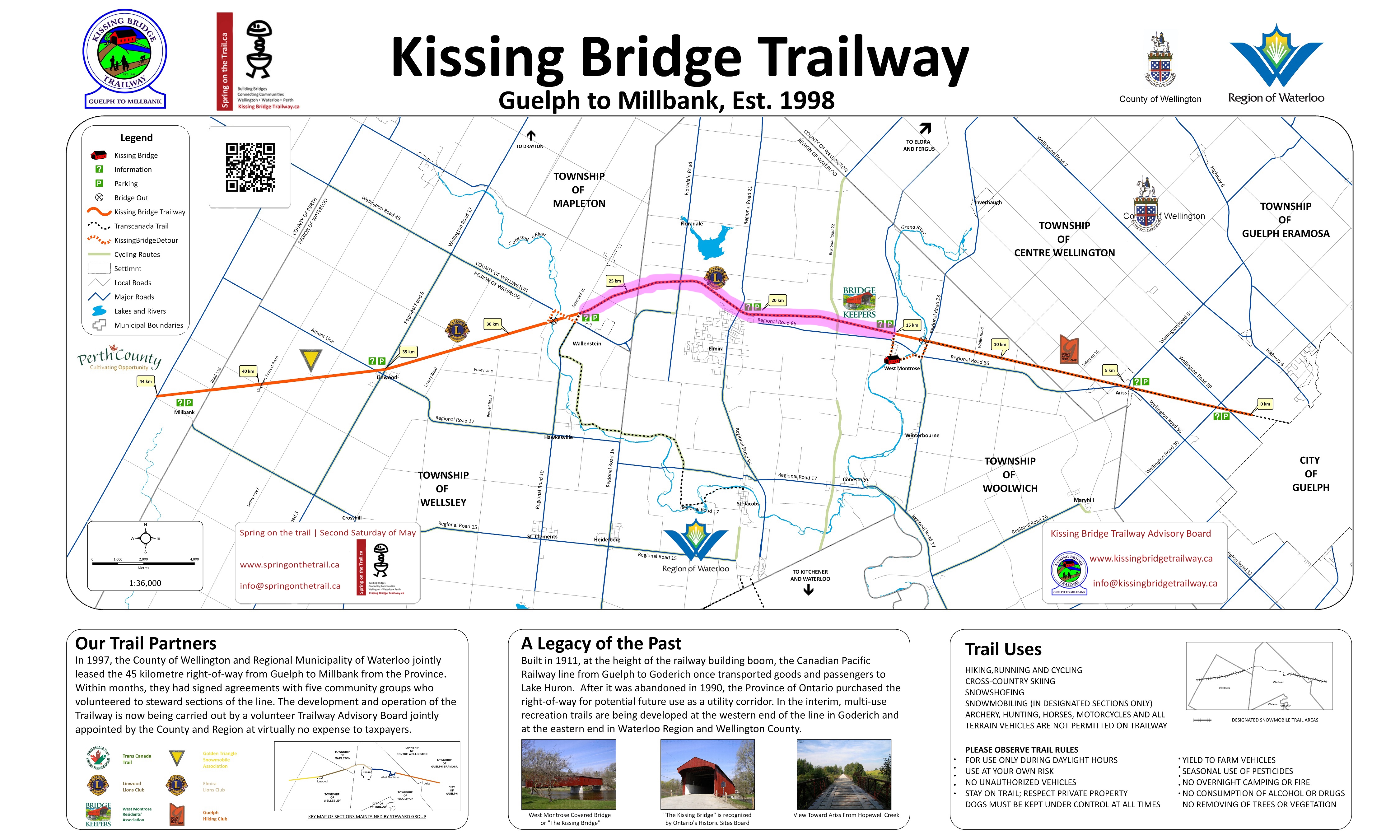
- Terrain: Flat, fine stone chip Rail Trail (suitable for any bike except road bikes)
- Parking (East): Middlebrooke station (8-10 car parking), 6055 Middlebrook Road, West Montrose, ON
- Parking (West): Wallenstein Kiosk (3-4 car parking), 6385 Yatton Side Rd, Elmira, ON
- Extra Parking: Letson Park (5-10 car parking), 1232 River's Edge Drive, West Montrose, Ontario.
- Washrooms: One portable bathroom at Letson Park, 1232 River's Edge Drive, West Montrose, Ontario.
- Food: Lost Acre Variety (General Store), 12 Covered Bridge Dr, West Montrose, ON (Closed Sunday and Monday)
- Bike Repair Stand: On the trail, on the side of the building west of 20 Arthur St N, Elmira ON (has bicycle pump)
- Nearby Attraction: West Montrose Covered bridge, the last remaining covered bridge in Ontario.
- Other facilities: Outdoor library (take a book, leave a book) at Letson Park, 1232 River's Edge Drive, West Montrose, Ontario.
Mennonite country. Expect to see (and smell!) lots of flat farmland, along with the occasional Mennonite horse-drawn carriages at road crossings. If it's not a Sunday, you may also see some "honor system" kiosks near road intersections with drinks and/or snacks for purchase.
Section 3: Wallenstein to Millbank
Section Last ridden: Spring 2022 (partially)
- Terrain: (to be verified) Flat, fine stone chip Rail Trail (suitable for any bike except road bikes)
- Parking (East): Wallenstein Kiosk (3-4 car parking), 6385 Yatton Side Rd, Elmira, ON
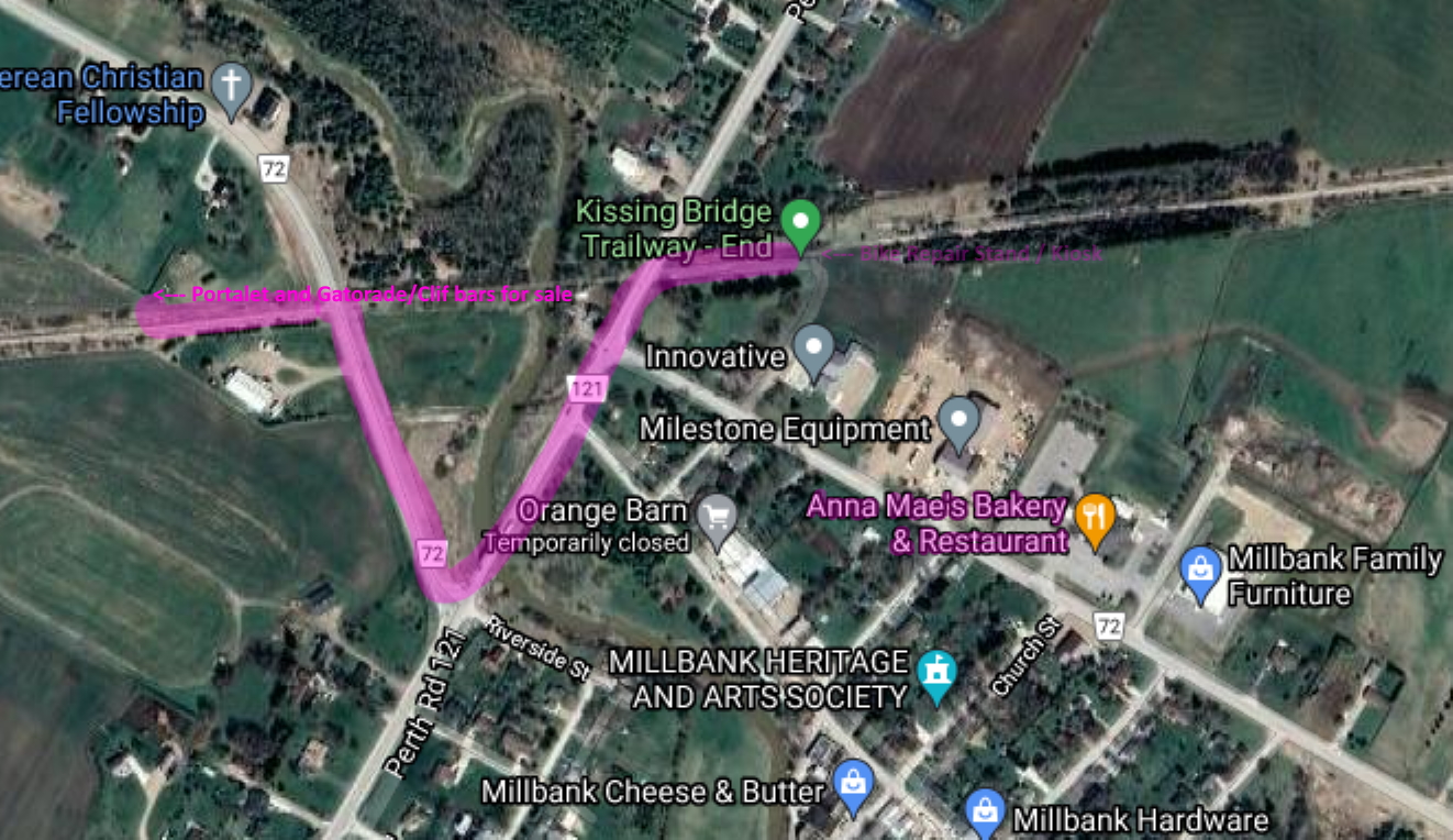
- Parking (West): 7021 Perth Road 121, Millbank, ON
- Extra Parking: (to be verified)
- Food: Anna Mae's Bakery & Restaurant, 4060 Perth County Line 72, Millbank, ON N0K 1L0 (CLOSED Sundays and Holidays; CASH/DEBIT only; NO CREDIT CARDS). A full service, family owned & operated Mennonite Restaurant and Bakery.
- Washrooms: As of May 2022 there is a privately-owned (but still officially part of the trail) rest stop (washroom, and drinks payable by honor system (but not on Sunday)) less than 1km west from the end of the trail (technically a few meters after the start of Perth Harvest Pathway (PHP) part of the G2G). There is a washroom in the store portion of Anna Mae's too if you were going to eat there anyway.
- Bike Repair Stand: There is one (no pump) at the trailhead in Millbank. Looks like there is a bike repair stand at both ends of the Kissing Bridge Trail.
- Nearby Attraction: There might (not sure due to COVID) still be a "Who are the Amish?" media presentation booth/shack in the Anna Mae's parking lot near the picnic tables.
Recommendation is to start from the West at Millbank, and on any day OTHER than Sunday or a holiday (everything is closed there on Sundays and holidays). Expect to see (and definitely smell!) lots of flat farmland. Can get very windy (bring a windbreaker and a face covering), and booooooooooring. The highlight of the entire ride would be Anna Mae's Bakery & Restaurant's "broasted chicken" (essentially fried chicken) and pies (both featured on Food network's "You Gotta Eat Here" show). At Anna Mae's, there does not seem to be any dedicated spot to lock your bike. Either leave the bike in/on your car (which is why I recommended starting at Millbank) or lock it against one of the benches near the store entrance (separate entrances for the store and for the dining area). You could also take your chicken/pie order to go, and sit at the picnic tables on the West side of the building.
Milverton (west of Millbank; no longer part of KBT but another part of the G2G trail network (Perth Harvest Pathway, recently completed on July 29, 2020)) is Amish country, and Millbank is both Amish and Mennonite. What's the difference, especially in Ontario? This website can clarify a bit (lots of information and research has been made), but be aware that there are over 30 different groups of Amish and Mennonite... from having no indoor plumbing on one extreme to embracing some degree of technology in another extreme.